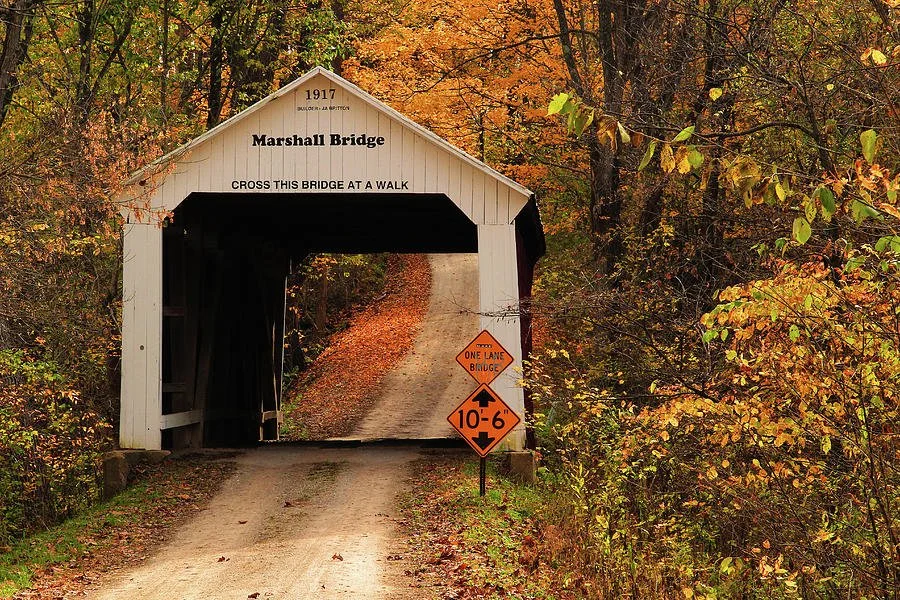
Marshall Covered Bridge
- Built: 1917 by Joseph A. Britton (at age 80)
- Creek: Rush Creek
- Location: 2.5 miles SW of Tangier
- Size: 56 ft long + 9 ft overhang; 10 ft 6 in clearance
- Truss Type: Burr Arch, single span
- Foundation: Concrete
History
- Despite its name, the bridge is unrelated to the town of Marshall. It was likely named for David W. Marshall, owner of the nearby Hill Crest Valley Farm, though some suggest Civil War veteran Mahlon Marshall.
- The C&EI Railroad once ran near the bridge but was abandoned after bankruptcy in 1921 and dismantled in 1943.
- This was Britton’s second-to-last covered bridge in Parke County, built when he was 80 years old.