Blog

  • Aaron’s on the Square

    Aaron’s on the Square

    123 S Jefferson St, Rockville, IN 47872

    We are a casual breakfast and lunch establishment.

    We specialize in breakfast, lunch, and pizza after 2. We also carry various flavors of dippin’ dots.

    (765) 731-1500

    123 S Jefferson St, Rockville, IN 47872

    Get Directions

    Website

  • Amore Pizza King

    Amore Pizza King

    1195 N Lincoln Rd, Rockville, IN 47872

    Same great pizza you have enjoyed for over 50 years – with a new twist!

    Come relax and enjoy the ambience in our little Italian Restaurant.  We offer pizza, pasta, sandwiches, salads, appetizers and a great selection of beer and fine wines.  Enjoy a ciabatta bread and dipping oil, or an order of breadsticks, while listening to the sounds of Frank and Dean!

    Dine In, Carry Out, or Drive Up Window.

    (765) 569-6330

    1195 N Lincoln Rd, Rockville, IN 47872

    Get Directions

    Website

  • Mansfield Covered Bridge (#5)

    Mansfield Covered Bridge (#5)

    Mansfield Covered Bridge

    • Built: 1867 by Joseph J. Daniels
    • Creek: Big Raccoon Creek
    • Location: Mansfield, near the historic mill and dam
    • Size: 247 ft long + two 16 ft overhangs; 16 ft wide; 10 ft 6 in clearance
    • Truss Type: Double Burr Arch, two-span
    • Foundation: Hewn limestone block
    • Cost: $12,200

    Repairs & Restoration

    • Closed in 1980 for abutment, roof, and deck repairs
    • Roof and deck replaced in 1990 by County Highway Dept.

    Village & Mill History

    • Settled in 1819 by James Kelsey (from Ireland).
    • First mill (1820) expanded over time but became outdated.
    • Jacob Rohm rebuilt the dam and mill in 1880; later tied to the railroad and quarry.
    • In 1913, a 180 ft concrete dam with a fish ladder replaced the wooden one.

    Bridge Construction & Controversy

    • Overseen by Commissioner Col. Johnston in 1867, raising conflict-of-interest concerns.
    • Daniels contracted Dec. 1866; bridge completed Sept. 1867.

    Strength & Modern Use

    • Built for wagons, still supports a 10-ton load limit.
    • Famously withstood three stalled oil trucks without damage.

    Gauging Station

    • Located southwest of the bridge, monitors water levels and flow from Mansfield Reservoir.
  • Leatherwood Station Covered Bridge (#25)

    Leatherwood Station Covered Bridge (#25)

    Leatherwood Station Covered Bridge

    • Built: 1899 by Joseph A. Britton
    • Relocated: 1981 to Billie Creek Village, rebuilt by Elmer Buchta
    • Creek: Originally Leatherwood Creek; now spans Williams Creek
    • Location: First site NW of Rockville; moved August 12, 1981
    • Size: 72 ft long + two 9 ft overhangs; 16 ft wide; 14 ft clearance
    • Truss Type: Burr Arch, single span
    • Foundation: Sandstone (original); concrete with sandstone (current)
    • Cost: <$680 originally; $50,000 relocation
    • Also Known As: Harry Wolf Bridge

    Local History

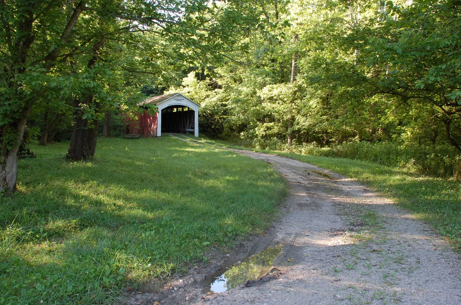
    Leatherwood Station, named for the creek and B&O Railroad stop, once thrived with pottery, milling, and small hamlets like Potters Town and Java. Bloomingdale, founded in the 1820s, lay nearby.

    Design & Construction

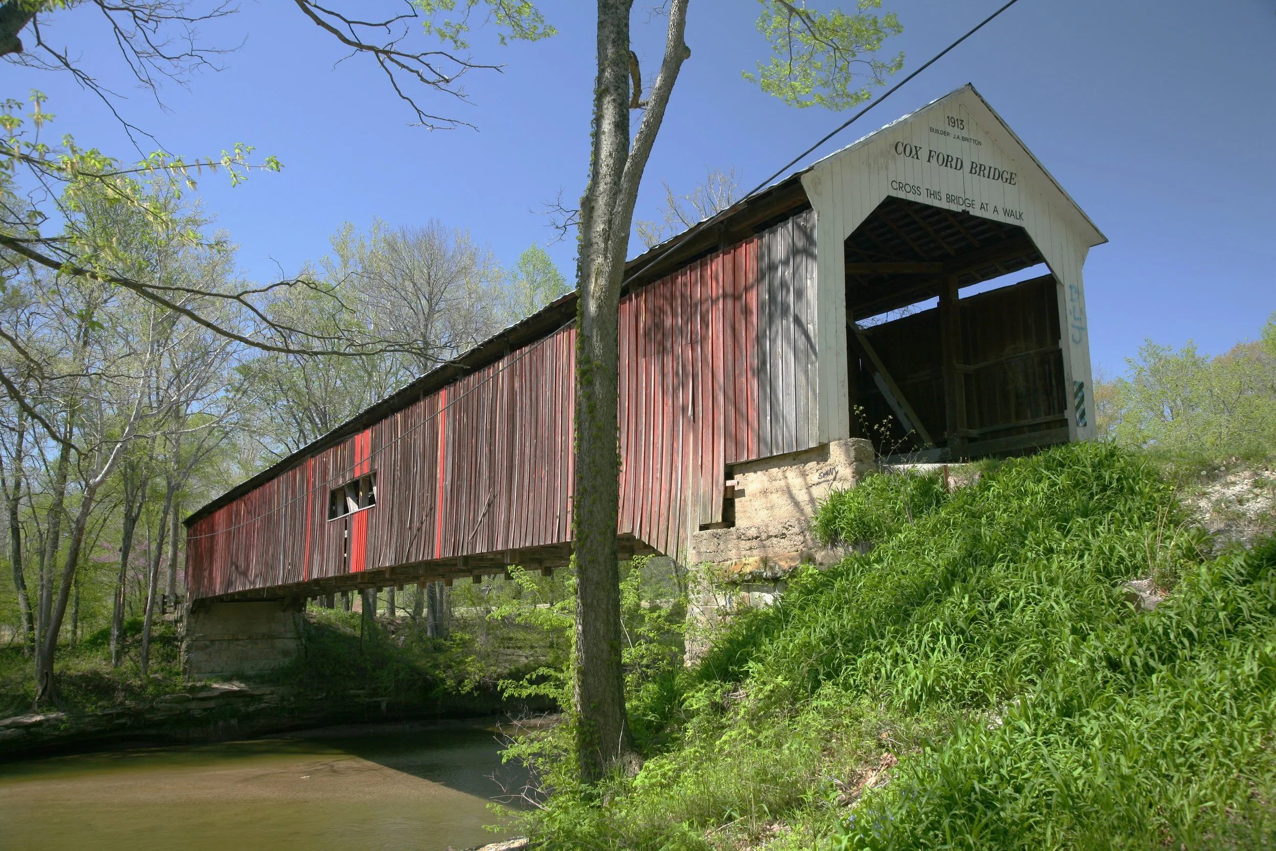
    Though Britton built the bridge, its portal was later altered to resemble Joseph J. Daniels’ style. Daniels himself had bid on the project but lost to Britton’s lower offer.

    Relocation & Present Use

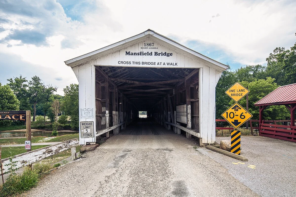
    Moved to Billie Creek Village in 1981, the bridge now serves as a pedestrian and horse-drawn crossing, preserving its historic character in a park-like setting.

  • Harry Evans Covered Bridge (#19)

    Harry Evans Covered Bridge (#19)

    Harry Evans Covered Bridge

    • Built: 1908 by Joseph A. Britton
    • Creek: Rock Run (formerly Iron Run)
    • Location: 0.5 miles NW of Coxville
    • Size: 65 ft long + two 8 ft overhangs; 16 ft wide; 13 ft clearance
    • Truss Type: Burr Arch, single span
    • Foundation: Concrete

    History

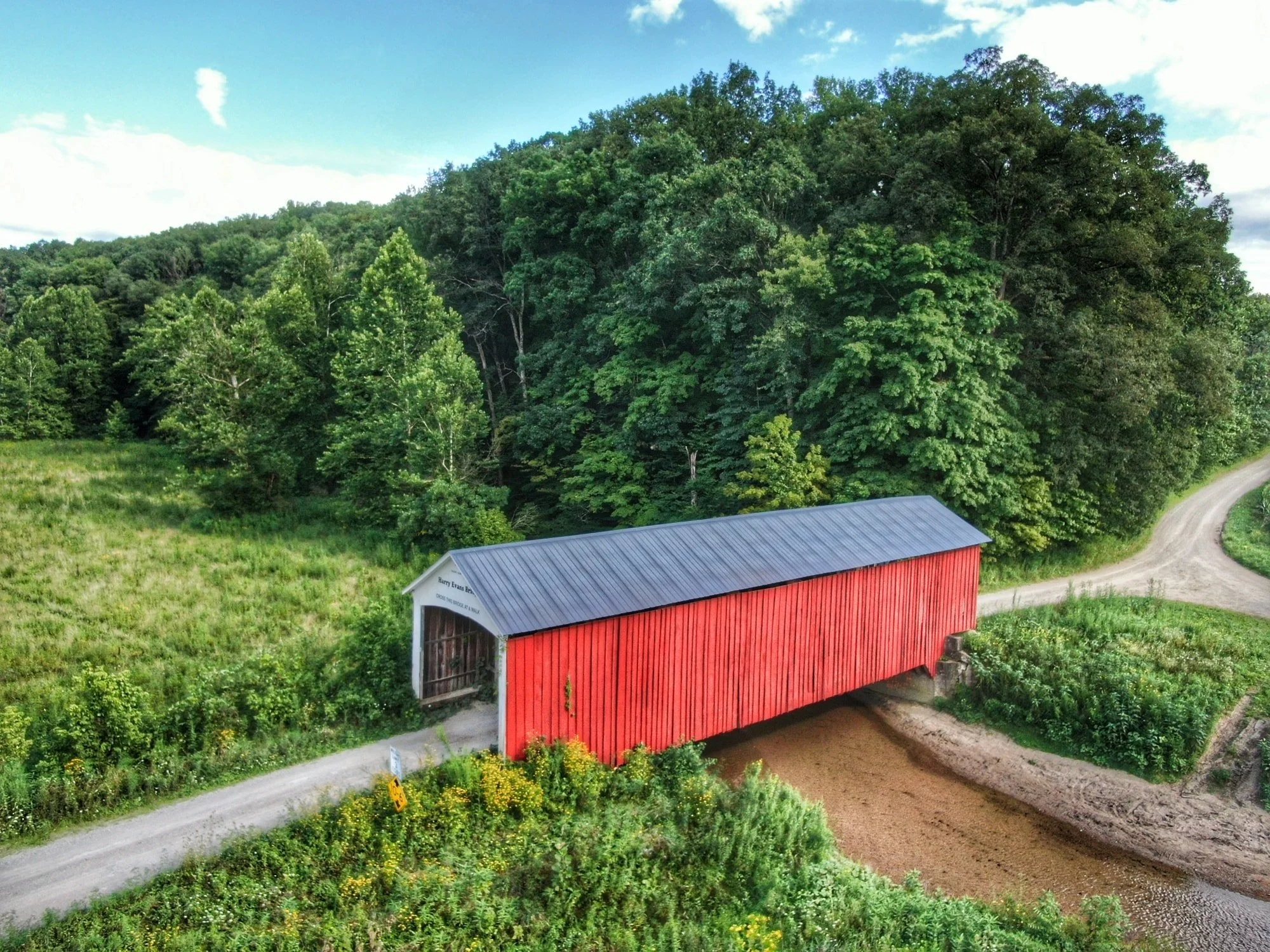
    Constructed in 1908, the Harry Evans Bridge shares design traits with Britton’s other bridges from the same year, including Zacke Cox and Weisner.

    Name & Local Debate

    Named after Harry Evans, who owned the surrounding land, though some locals believed it should honor another Evans family member who lived closer to the bridge. The Evans family retained the land until the 1960s.

    Landscape

    The area is prone to road washouts, with a nearby ford maintained for access. Surrounding hills contain abandoned coal mines, including a deep, seemingly bottomless air shaft that adds a mysterious touch to the site’s industrial past.

  • Crooks Covered Bridge (#12)

    Crooks Covered Bridge (#12)

    Crooks Covered Bridge

    • Built: 1856–1857 by Henry Wolf
    • Rebuilt/Relocated: 1867 or 1872 (attributed to Gen. Arthur Patterson or Joseph J. Daniels)
    • Creek: Originally Little Raccoon (now Molasses); relocated to Little Raccoon
    • Location: 5 miles SE of Rockville, along the “Red Route”
    • Size: 132 ft long + two 11 ft overhangs; 14 ft wide; 13 ft clearance
    • Truss Type: Burr Arch, single span
    • Foundation: Hewn stone
    • Cost: Estimated $1,200–$5,900
    • Also Known As: Walker Adams Bridge or Darroch’s Lost Bridge

    History & Relocation

    • Damaged in the 1875 flood and repaired.
    • Originally tied to Parkers Mill (1830) at “Indian Crossing.”
    • Creek shifts and floods led to relocation; some accounts suggest Patterson rebuilt it in 1872, others that floodwaters carried it to its current site.
    • Daniels was also involved, proposing a safer relocation in 1867.

    Forgotten Crossing

    • For years, no formal road reached the bridge, earning it the nickname Lost Bridge.
    • Local lore recalls travelers stumbling upon it while searching for a safe crossing during floods.
  • Cox Ford Covered Bridge (#36)

    Cox Ford Covered Bridge (#36)

    Cox Ford Covered Bridge

    • Built: 1913 by Joseph A. Britton
    • Creek: Sugar Creek
    • Location: East of US 41, north of IN-47, west of Turkey Run State Park
    • Size: 176 ft long + two 8 ft overhangs; 16 ft wide; 13 ft clearance
    • Truss Type: Burr Arch, single span
    • Foundation: Concrete poured over original stone ($385)
    • Cost: $4,235

    History & Repairs

    • First bridge at Cox Ford was an iron span (1896), destroyed in the 1913 flood.
    • Britton built the replacement using arches from the washed-out Armiesburg Bridge and raised it 5 ft for protection.
    • Deck replaced in 1975.

    Family Craftsmanship

    • Likely a Britton family effort: Joseph A. Britton led, with help from his father Charlton (who may have sawn the arches) and his sons, including Edgar.
    • In the same year, Britton also built the Howard and State Sanatorium bridges.

    Local Lore

    • A 1920 fishing tale tells of two men hauling a 47-pound catfish from beneath the bridge—one of many giant catches once common in Sugar Creek.

    Today

    • The bridge sits at the edge of Turkey Run State Park, with nearby parking and a canoe landing, making it a favorite spot for visitors and paddlers.

  • Conley’s Ford Covered Bridge (#7)

    Conley’s Ford Covered Bridge (#7)

    Conley’s Ford Covered Bridge

    • Built: 1906–1907 by J. Lawrence Van Fossen
    • Creek: Big Raccoon Creek
    • Location: 2 miles SW of Mansfield, between Mansfield and Bridgeton
    • Size: 192 ft long + two 10 ft overhangs; 16 ft wide; 13 ft clearance
    • Truss Type: Double Burr Arch, single span
    • Foundation: Concrete

    Repairs

    • Resided and reroofed in 1991 with corrugated steel and fresh paint.

    History & Design

    • Built of white pine, unusual in Parke County, and among the longest single-span covered bridges in the world.
    • Constructed the same year Jefferson P. Van Fossen built Adam’s Bridge; Jefferson later built Jessup and Roseville bridges.
    • The Van Fossens often collaborated with Joseph J. Daniels, adopting his signature “Daniels Arch.”
    • In 1991, original Daniels-style portals were replaced with Britton-style portals.

    Historical Notes

    • Early portals listed county officials and the builder; fragments of names survive in old photos.
    • The sign “Cross This Bridge At A Walk” refers to horses—meant to prevent damaging vibrations from a gallop.
  • Billie Creek Covered Bridge (#39)

    Billie Creek Covered Bridge (#39)

    Billie Creek Covered Bridge

    • Built: 1895 by Joseph J. Daniels
    • Creek: Williams Creek
    • Location: East of Rockville, in Billie Creek Village
    • Size: 62 ft long + two 8 ft overhangs; 15 ft wide; 12’6 clearance
    • Truss Type: Burr Arch, single span
    • Foundation: Cut sandstone by J.L. Van Fossen
    • Cost: $820

    History & Construction

    • Replaced an 1880 J.A. Britton bridge, likely uncovered and short-lived.
    • Daniels won the contract with a lower bid than Britton; Van Fossen built the sandstone abutments using stone from a nearby quarry.
    • Daniels and the Van Fossens later collaborated on the 1910 Roseville Bridge.

    Significance

    • Once part of the Pikes Peak, Plank Road, and Ocean-to-Ocean Road (later US 36).
    • Saved from demolition when the highway was rerouted, unlike other bridges lost to road expansion.

    Billie Creek Village

    • Now part of a heritage site featuring relocated historic buildings, including a church, school, and general store.
    • Nearby covered bridges such as Beeson and Leatherwood Station were also moved here.

    Today

    • Still in use but often closed for traffic control. During Covered Bridge Festivals, it serves as both a functional crossing and a centerpiece of the village’s historic attractions.
  • Bowsher Ford Covered Bridge (#32)

    Bowsher Ford Covered Bridge (#32)

    Bowsher Ford Covered Bridge

    • Built: 1915 by Eugene Britton (contractor: Elmer Garrard)
    • Creek: Mill Creek (Wabash)
    • Location: 2 miles NW of Tangier
    • Size: 72 ft long + two 10 ft overhangs; 16 ft wide; 13 ft 6 in clearance
    • Truss Type: Burr Arch, single span
    • Foundation: Concrete

    History

    • Contract awarded to Elmer Garrard, who brought in the Britton family; Eugene Britton credited as builder.
    • Built the same year the Brittons also worked on Jeffries Ford, Rolling Stone, and Sharpe bridges.

    Legacy & Naming

    • Named for the Bowsher family, longtime landowners at the ford.
    • Features a wood shingle roof; a full-scale replica stands nearby as a farm shed.

    Design Notes

    • Similar in size and layout to Joseph J. Daniels’ Big Rocky Fork Bridge (1900), though that bridge is noted for its stone abutments and Daniels’ trademark arched portal.