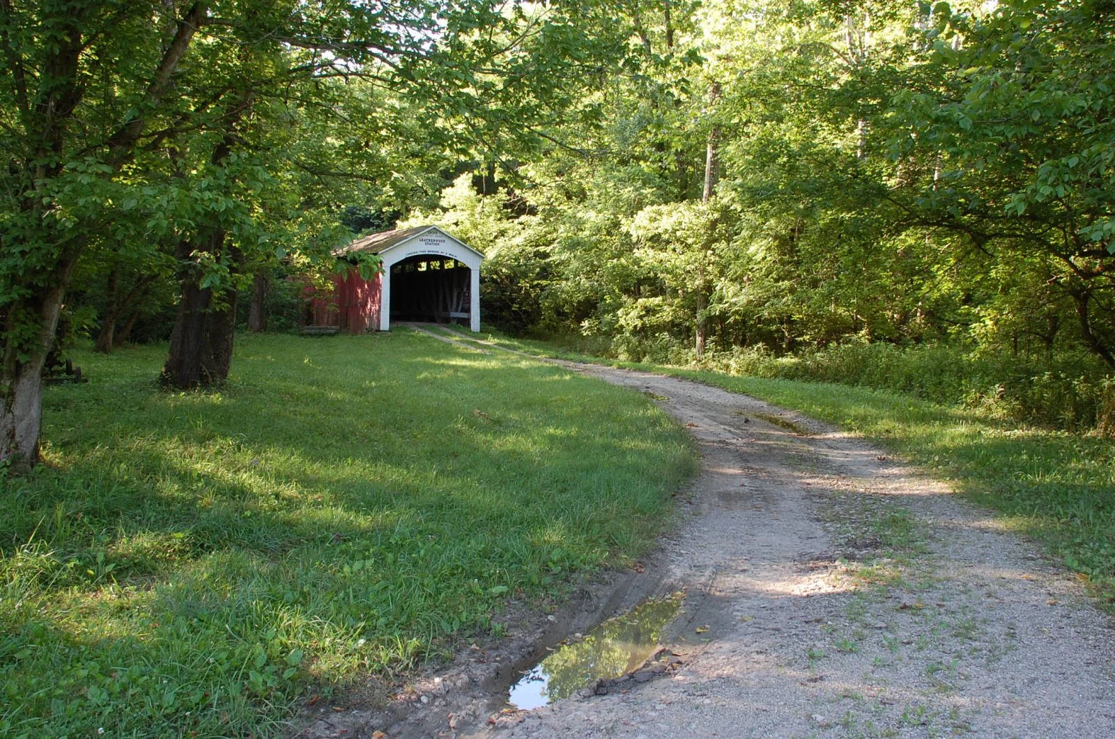
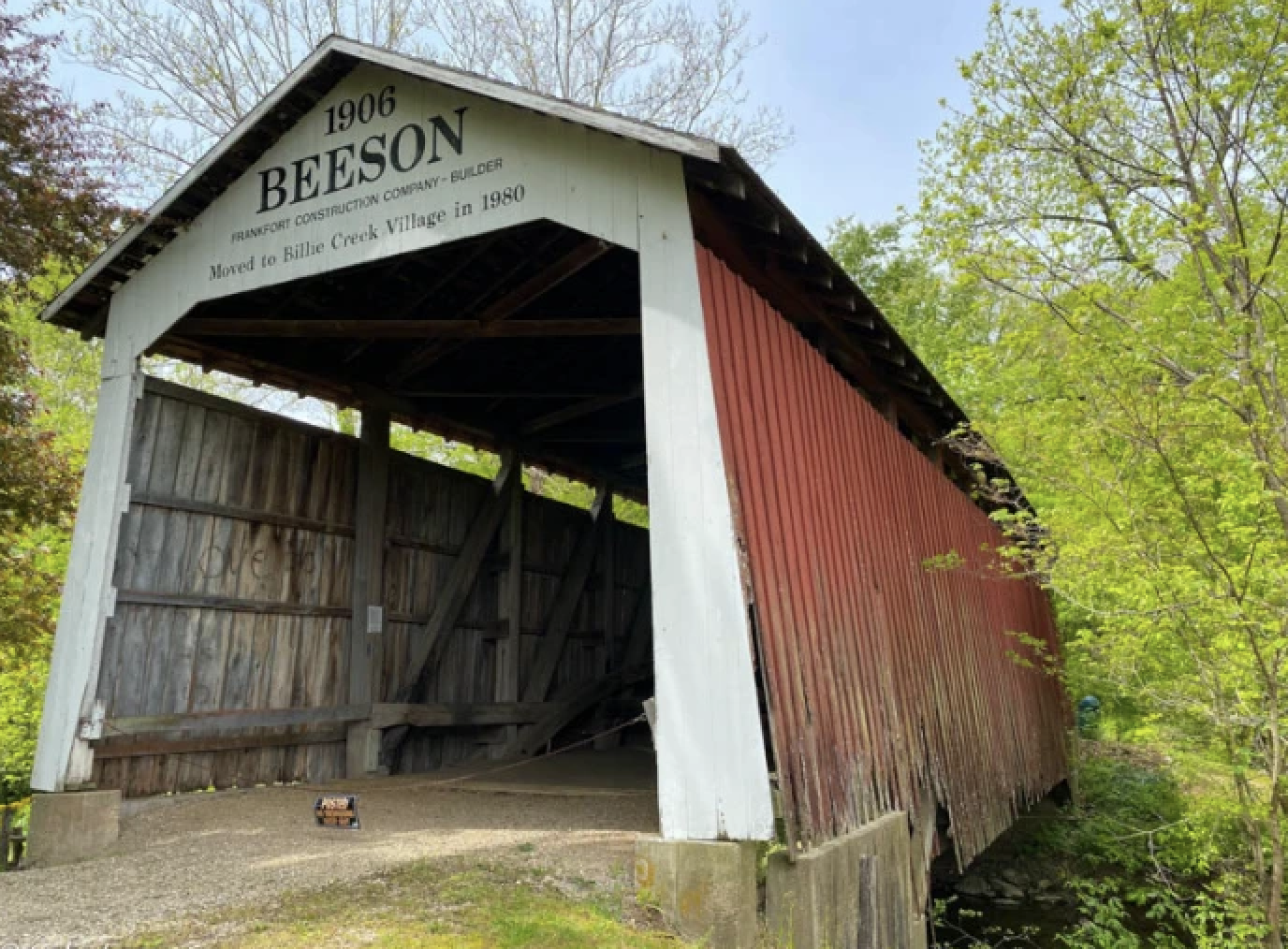
Leatherwood Station Covered Bridge
- Built: 1899 by Joseph A. Britton
- Relocated: 1981 to Billie Creek Village, rebuilt by Elmer Buchta
- Creek: Originally Leatherwood Creek; now spans Williams Creek
- Location: First site NW of Rockville; moved August 12, 1981
- Size: 72 ft long + two 9 ft overhangs; 16 ft wide; 14 ft clearance
- Truss Type: Burr Arch, single span
- Foundation: Sandstone (original); concrete with sandstone (current)
- Cost: <$680 originally; $50,000 relocation
- Also Known As: Harry Wolf Bridge
Local History
Leatherwood Station, named for the creek and B&O Railroad stop, once thrived with pottery, milling, and small hamlets like Potters Town and Java. Bloomingdale, founded in the 1820s, lay nearby.
Design & Construction
Though Britton built the bridge, its portal was later altered to resemble Joseph J. Daniels’ style. Daniels himself had bid on the project but lost to Britton’s lower offer.
Relocation & Present Use
Moved to Billie Creek Village in 1981, the bridge now serves as a pedestrian and horse-drawn crossing, preserving its historic character in a park-like setting.